Sunday, October 15, 2017

Back to New Bern, North Carolina

Church in Essex, CT
Our plan forever changes... just when you think you are set the weather report changes yet again!  We got all involved with trying to fix the autopilot and didn't check the weather for a day or two.  That was a mistake as in that length of time everything changed.  We had planned to go up the coast overnight from Cape May, NJ to Norfolk, VA.  The day we had planned to go looked alright but by the time we would arrive in Virginia the wind would be blowing 30 knots steady!  So we took off instead and headed up the Delaware Bay to the Chesapeake/Delaware Canal.  We had high hopes that we would make it all the way to Delaware City in one day - unfortunately that did not happen.  We ended up anchoring in the Cohansey river for two nights as the wind picked up again the next day.  High winds against a strong current makes for a treacherous situation.  So we waited... again.
Regatta on Long Island Sound

Once we got to the canal that connects the Chesapeake Bay and Delaware Bay we were golden.  Over a week of perfect weather.  So we made our way down the Chesapeake and onto the AICW pretty quickly.  Amazing how fast you can move with good weather!
East River - New York City
 We made it back to New Bern before predicted thunderstorms - it was raining when we arrived but no lightening.  So that's it - we have sailed up the entire east coast.  Now we are setting our sites on Europe.  2018 will be spent upgrading the boat and preparing ourselves for a transatlantic crossing. Spring 2019 we plan to join a rally and sail to the Mediterranean.  Stay tuned.
Off loading platform for oil tankers in the Chesapeake Bay

Wednesday, October 11, 2017

Sunrises and Sunsets

Sunrise over Atlantic Highlands, NJ
We did finally make it to the Connecticut river two days before we were to have high winds from hurricane Jose which would be skirting the coast of Long Island.  Enough time to stow all our canvas, rent a car and get a hotel room for the night.  But, of course, as Jose had done all along - he stalled.  So the night we spent in a hotel was mild but when we got back on the boat the wind came.  Truly it wasn't too bad though - we had weathered a rougher night in Maine during a nor'easter.  We stayed on the Connecticut river a couple of days but once the wind calmed down enough we took off.  Now we were trying to make it to Cape May, NJ before hurricane Maria started moving up the east coast.  Forever dodging hurricanes!
 We sailed from Essex, CT to Port Jefferson, NY.  It was one rough day on Long Island Sound!  We got hit by some pretty big waves and were very glad to reach our destination that day.  Our "weather window" to reach Cape May, NJ was fairly short.  The winds from hurricane Maria were going to be pretty high and the sea was all churned up.  NOAA was predicting 27 foot waves in the coastal waters!  We wanted no part of that.  
Sunset - Cohansey River
 So - the next day we went all the way through NY harbor and over to Atlantic Highlands, NJ.  We wanted to reach Cape May within three days as that was all the time we had.  At least if we reached Cape May we had options.  If the weather wasn't settled enough to sail on the ocean we could always travel up the Delaware Bay and then down to Chesapeake Bay.  From there we could get on the Atlantic Intracoastal Waterway all the way to New Bern, NC.  
 Our plan was good and we did reach Cape May just in the nick of time.  The next day the wind was blowing 20-30 knots and stayed that way for several days.  Unfortunately, that wind prevented us from going up the Delaware as well.  There we sat stuck in Cape May, NJ waiting for an opportunity to either make an overnight run for Norfolk or up the Delaware.  Hurricane Maria was just off the coast of Cape Hatteras.  Time for laundry and working on the autopilot which has decided to quit working. 

Tuesday, October 10, 2017

Into the Mystic

So we left Martha's Vineyard on the 14th of September to sail to Cuttyhunk.  Cuttyhunk is the only one of the Elizabeth Islands that is not privately owned.  From there our goal was to sail to Stonington, CT on Long Island Sound and then to Essex, CT.  Essex is about 5 miles up the Connecticut river, also off of Long Island Sound, which we hoped would be far enough from any weather related to hurricane Jose. 
Cuttyhunk Island
 It was foggy that morning and we had to wait till the tidal current was in our favor to make the passage.  By mid-morning we thought the fog was clearing enough so we took off.  But... the further we sailed into Vineyard Sound the thicker the fog became.  It was like sailing into a huge cloud.  We could not see a thing so we chickened out and turned around determined to try again the next day.  
Cuttyhunk Ferry Terminal
As planned the next day we set out again.  Initially, we thought it looked a bit better but once again the further we sailed into Vineyard Sound the foggier it became.  This time we decided to turn on our radar and keep going as we were running out of options.  We could not wait any longer as we had to get away from there and to our safe spot before Jose reached the area.  There is a passage that you have to go thru between the islands called Quick's Hole.  There is land on either side of the passage - but we saw no land or bouys.  We did not even see the huge fishing boat that passed right by us.  The only way we knew he was there was by his call to us on the VHF radio.  He said I am going to pass you - hold your course.  And then he sounded his foghorn once past.  We heard the horn but never saw the boat!!
Mooring field at Cuttyhunk
Right as we reached Cuttyhunk the fog cleared enough for us to get through the inlet.  And then about an hour later the fog just settled right down again and everything disappeared. 
Cuttyhunk is a very small island with a handful of full time residents.  Sailors love to visit though because it is such a unique place.  And we were able to get some Quahog which I love!
No Wal-Mart here.  This little market is all there is.  If you want anything else you have to take the ferry to the mainland.
Cuttyhunk Grocery
The next day our goal was Stonington, CT.  When we got up the fog was again so thick you could see next to nothing.
We kept waiting and waiting for the fog to lift but it was not going to happen.  Finally, when we were able to see the jetty for a few minutes we took off thinking if we can just get through the inlet surely the fog won't be as thick on Buzzard's Bay.  We were totally wrong about that. The fog was just as thick on Buzzard's Bay.  Our goal was Stonington but in light of the fog we changed course for Newport, RI.  The fog was so thick we could barely see past the bow of the boat.  As we were entering Newport Harbor we started seeing all kinds of boats on the radar!  Fortunately, the fog suddenly lifted as there were many, many boats in the harbor.  The boat show was that weekend and there was a regatta.  Thank goodness for small favors!
Cuttyhunk Inlet
All told we spent four long days sailing through dense fog.  Trying times for sure.  One thing for sure we were able to hone our radar skills!

Wednesday, September 27, 2017

Martha's Vineyard

Resist -Gotta love Massachusetts!
As it turned out we decided that since Hurricane Jose was now turning our way perhaps a trip to Nantucket would be pushing it.  We did not want to be stuck out in the islands with a hurricane bearing down on us.  So our new plan was to visit Martha's Vineyard and then head into Long Island Sound (originally our plan was to sail from Block Island, RI to Cape May, NJ but Jose put an end to that plan).  We decided we would go up the Connecticut River in Long Island Sound as far as Essex and wait out the hurricane.  Determined to squeeze in a visit to Martha's Vineyard we headed that way before heading to the Sound.
Oak Bluffs Cottage
 In order, to reach Martha's Vineyard we had to sail through Woods Hole Passage.  The current runs very swift through the passage and there are numerous buoys marking different areas that make it confusing for a stranger.  It is necessary to study the chart and mark your passage well or risk getting dashed up against rocks that are conveniently located in the middle of the passage!  The current runs about 4 knots and sometimes higher.  Talaria was speeding along at 10 knots!!  Martha's Vineyard was named for Bartholomew Gosnold's deceased daughter Martha.  Gosnold is credited with the first known European expedition to Cape Cod.  The story is that when Gosnold first saw Martha's Vineyard the island was covered with wild grapevines.  Hence, Martha's Vineyard.  Wild grapevines are still all over the island they are just not as noticeable as in 1602 apparently.  Gosnold is credited with naming Cape Cod and the nearby Elizabeth Islands as well.  Martha's Vineyard has 6 towns and you can ride around the entire island in a day - which we did.  We moored Talaria in Oak Bluffs and then took the city bus all around the island!  
Oak Bluffs, one of the six towns on Martha's Vineyard Island is known for its little cottages.  This area of the town was once a Methodist camp.  People came year after year and set up tents and then eventually built the little cottages.  Those cottages are really a site to see.  Each gingerbread house unique from the next. 


Cute!!

Little Pink Houses for you and me

Martha's Vineyard has no streetlights, no traffic lights or billboards!  Yay!!  We were pleasantly surprised by the lack of ostentatious homes - most were very humble.  Most all are cedar shake with white picket fences or stacked stone fences.  And there are not alot of paved roads - many are just dirt roads.  Surprising considering the affluence of Martha's Vineyard. 
Gay Head Cliffs

Gay Head now known as Aquinnah, the native Indian name, is at the other end of the island.  The native Americans who of course were living on the island long before the Europeans arrived used to make beautiful pottery from all the different colors of clay from the Gay Head cliffs.  But that has come to an end as the cliffs are eroding.  
The island is beautiful and not what we expected which made it even nicer.  Very glad we visited.  Nantucket another day!

Tuesday, September 26, 2017

Woods Hole

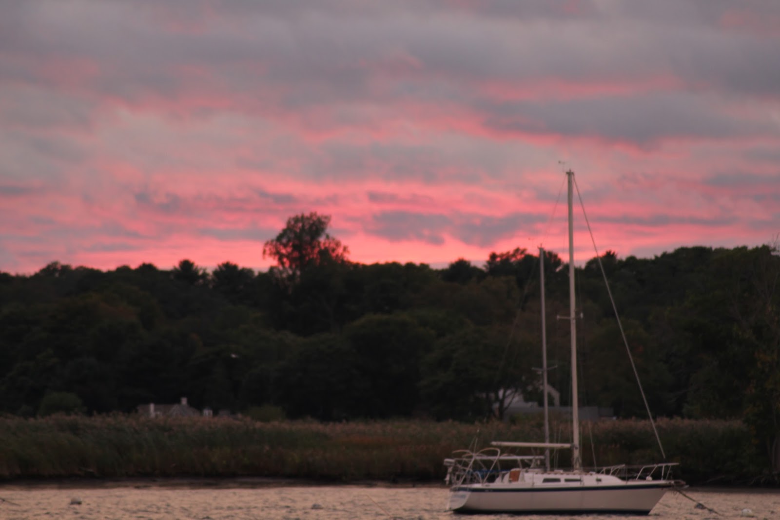
Sunset at Quissett Harbor
 Finally, we made it from Maine to Massachusetts!  After spending a couple of uneventful days traveling down the Massachusetts coastline we ran into some rough seas outside of Plymouth Harbor.  The waves were 4 to 5 feet with considerable ocean swell and the wind was blowing at 15 to 20 knots with higher gusts.  We were motoring out of the harbor but got the staysail up as soon as possible which evened things out a bit.  Regardless, it was a bit of a rough trip to the Cape Cod Canal.  Fortunately, it was only a couple of hours before we reached the canal and were able to get off the ocean for awhile!  The canal is a man made waterway that connects Cape Cod Bay to Buzzards Bay.  Without the canal you would have to travel hundreds of miles further going around Nantucket and the shoals that extend past Nantucket.  Our destination after the CCC was beautiful Quissett Harbor which was where we planned to stage a trip to Woods Hole.


Woods Hole, the marine science epicenter, has long been on our bucket list.  Home to WHOI, the largest independent oceanographic institution in the US and the Marine Biological Laboratory an international center for research.  Being an Illinois native I was surprised to discover that the MBL is affliated with the University of Chicago.  Something for Illinoisans to be proud of!  
It's reassuring to know that there are brilliant minds out there studying and trying to save the oceans.  They are our lifeblood.
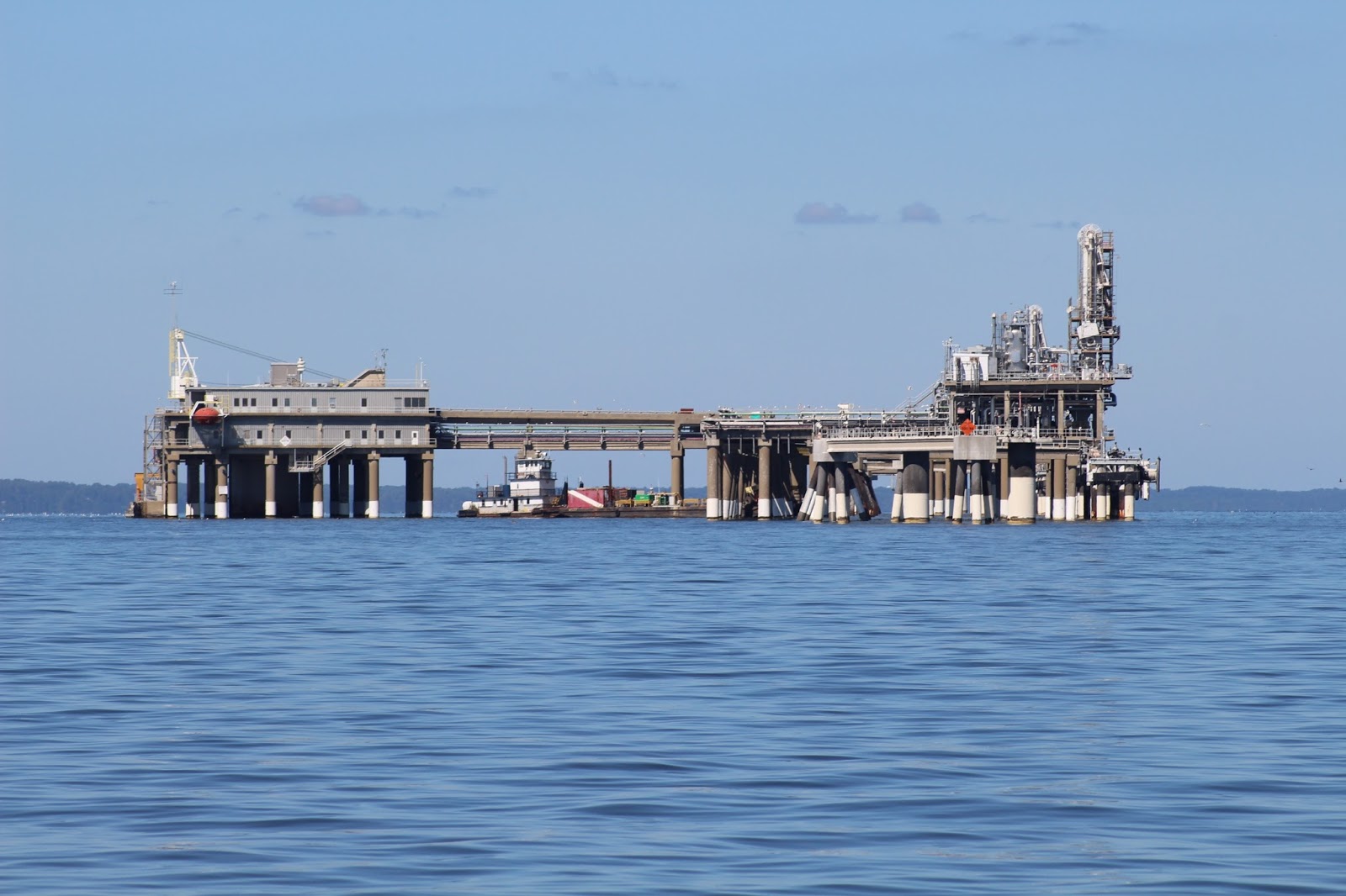
WHOI Research Vessel
Needless to say our oceans have been working overtime this year churning up hurricanes.  We have our eye on Hurricane Jose!  Due to the uncertainty and slow movement of Jose we have decided to stay north for awhile.  
Quissett Harbor
 So we decided since we are in the area we might as well sail over to Nantucket and Martha's Vineyard.  Who knows when we will be this way again??
12 1/2 Herreshoff Sailboats in Quissett Harbor


Wednesday, September 20, 2017

Heading back south

Portland Head Light - Portland, Maine

When we started this journey we thought we would spend maybe 4 to 5 years exploring the US before we set off to explore other countries.  We left Kentucky in 2014 and since then we have been up the entire east coast of the US with a side trip to Cuba.  It is now 2017 and we are headed back to North Carolina.  The plan is to put Talaria on the hard for the winter and then sail her to the Mediterranean in the spring.  There is much that has to be done before then but we are hoping we are ready.  
Beach in Plymouth, Massachusetts
 We departed from Rockland, Maine on September 2nd knowing that the trip back would not be as easy as the trip up.  Primarily because the prevailing winds in Maine are from the southeast. Precisely the way we need to go - well south anyway.  Weather is always the primary concern when sailing/cruising.  Sailors say the most dangerous thing on a boat is a "schedule" which of course we have.  Sadly, Mother Nature is fickle -absolutely no concern for how strong you want the wind to blow or from which direction.  So... of course, starting out the wind was from the wrong direction and there was too much of it.  Seas were running 6 to 7 feet.  Pounding into those types of seas is not fun.  We were gone one day - just one day- and already had to sit back and wait for favorable winds.  Like I said - having a schedule is a very bad thing.  We finally did make it as far as Portland - albeit in rough seas- but then had to sit and wait for about three days.  Portland is not a bad place to hang out - if you are stuck somewhere it may as well be there.  Time to stop and smell the roses (or the saltwater)!  
And we won't freeze as we had side curtains made while in Maine.  We do not have an enclosed cockpit and nearly froze on the way up.  That issue as least is solved.  Now if we can just coax the weather....

Isle au Haut

Duck Harbor
Isle au Haut - the pretty little island off the coast of Stonington, Maine is actually part of Acadia National Park.  Or at least 60% of the Island is park land.  Boaters can anchor in Duck Harbor and hike on the Island.  It is a small harbor as you can see - not many boats can fit.  
 Someone actually lived on that little island in the distance with his 5 children!  No place to hide.  But back to Isle au Haut - the park service maintains a few campsites on the Island.  People have to apply a year in advance!!  Very hard to get a spot and you may not get your first choice, you have to submit 2 dates in case you don't get the first.
The population on Isle au Haut is 73.  They did not get electricity until 1970 and no phone service until 1988.  It is still pretty primative and isolated.  And that is what people like.
But there is a church and a grocery - what more could you want?


And should you need more - you can always catch the ferry and head to Stonington for an evening out.
Although I must say - there is not much in Stonington either.  If you really get ambitious you can make your way to Rockland.  There you will find all the fast food restaurants and WalMart.  But who wants that??
There is something to be said for those who choose a simple life.  Living simply, simply living.


Tuesday, August 29, 2017

North Haven

Talaria on a mooring in the Fox Thoroughfare
On the days that I am not working and the weather is cooperative we sail to some nearby islands.  North Haven and Vinalhaven together make up the Fox Islands.  The islands are narrowly separated by a body of water called the Fox Thoroughfare. 
Notice how this structure is up on rock pilings!
 The Fox Islands are only 12 miles from Rockland.  So we sailed over there and grabbed a mooring ball in the Fox Thoroughfare.  

North Haven
 We took the dinghy and visited North Haven.  There are families there that have been on 
the island for generations.  North Haven has both year round residents and summer only residents.  Summer residents are mostly the Boston elite. 
And those Boston elite send their children out to learn to sail on their small Optimus sailboats.  This day they were sailing a little regatta.
In contrast to the small sailboats are the large Windjammers that sail thru the thoroughfare.  The windjammers are iconic Maine.  They were once used as merchant ships and fishing vessels.  Now they carry tourists but they are still a sight to behold!

Notice again how the buildings are resting on rock pilings!
 
North Haven
 Vinalhaven - the other Fox Island is a working man's island.  The island is home to primarily lobstermen who hold the fishing rights to most of Penboscot Bay.  Vinalhaven is larger and more populous.
There is apparently no shortage of lobster here - as evidenced by the vast number of lobster traps everywhere.  There is barely enough room for a boat on the water with all the lobster traps.  It is a constant battle to bob and weave through the traps without wrapping the lines around your propeller.  I have heard that the reason for the great number of lobsters is due to the extreme over fishing for other species.  Lobsters were left with no predators as the other fish populations are now gone.  Not sure if that is true but what is true is that lobsters are big, big business here. 


Monday, August 28, 2017

Acadia National Park

Acadia National Park - 47,000 acres of breathtaking beauty.  A visit in the summer is great but I am told by Mainers that fall is when Acadia really shines.
 All these little islands dotting the ocean.
The view from the top of Cadillac Mountain - the highest point on the east coast.
I can't say why I am so fascinated with surf on rocks - I could sit and watch all day.
We decided to hike one of the trails - this rock cairn is pointing you in the right direction.  They are unique little trail markers.  
Hiking over granite!  This is along our trail.
 
Pretty nice place to sail.  Doesn't get much better - sunshine, the wind always blows, the weather is perfect and the scenery is phenomenal. Bliss!